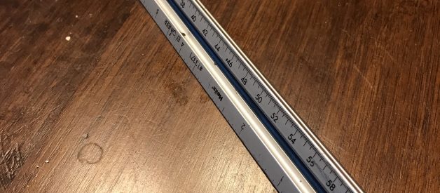
Anyone who reads or makes maps and drawings needs to know how to use an engineer?s scale. Why? Because maps, plan views, and to-scale drawings aren?t done with real-life dimensions, as there simply isn?t paper big enough to do that. So you need to be able to figure out how far an inch or a centimeter on the paper represents in real life. This funky looking ruler will help you with that.
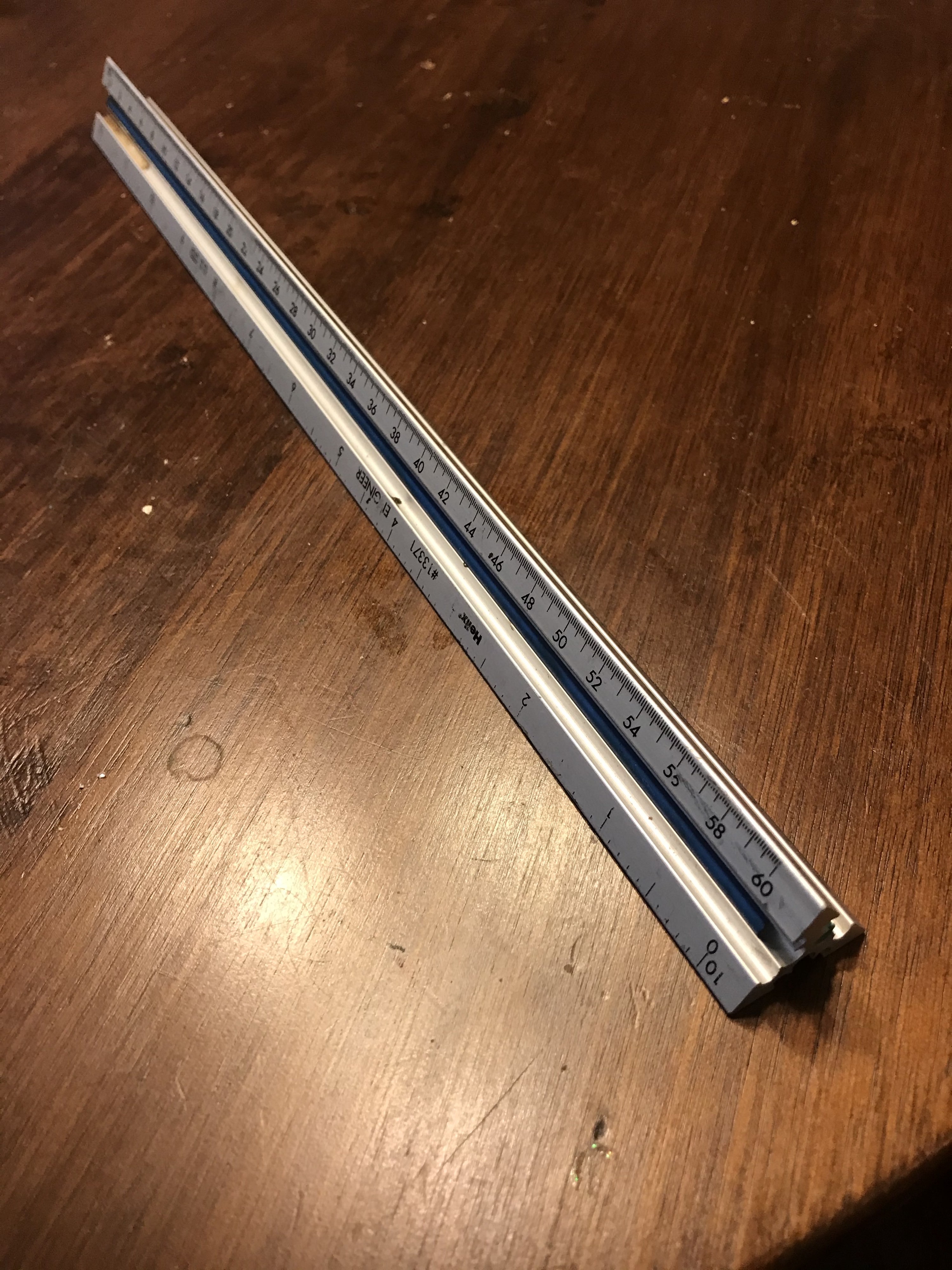 Engineer?s scale with 1:10 and 1:60 edges shown
The first thing to notice is that the scale has six marked edges. If you?re in the US, they will typically be multiples based upon an inch.
As you rotate the scale, you will see edges marked from 10 to 60 units per inch. That is to say, there is a side each for 1:10, 1:20, 1:30, 1:40, 1:50, and 1:60.
Note that there is also something called an architect?s scale, which is not base ten. It?s got less useful (except to architects?) dimensions, such as 1:3/4 or 1:3/32 or 1:3/8.
A diagram, map, or other drawing can be made to a standardized, consistent set of proportions with a tool such as this. An engineer?s scale can also be used to measure on a professionally produced map or diagram.
But surely distances and such are marked? Well, what if they?re not? Maybe you need to know the distance between two points on a map or drawing. Here?s how you do it.
- Find the established scale on the map. Any map that is worth the paper it?s printed on (or the screen it?s displayed on) will have a scale. Typically this will be located near the north arrow or in a corner of the map.
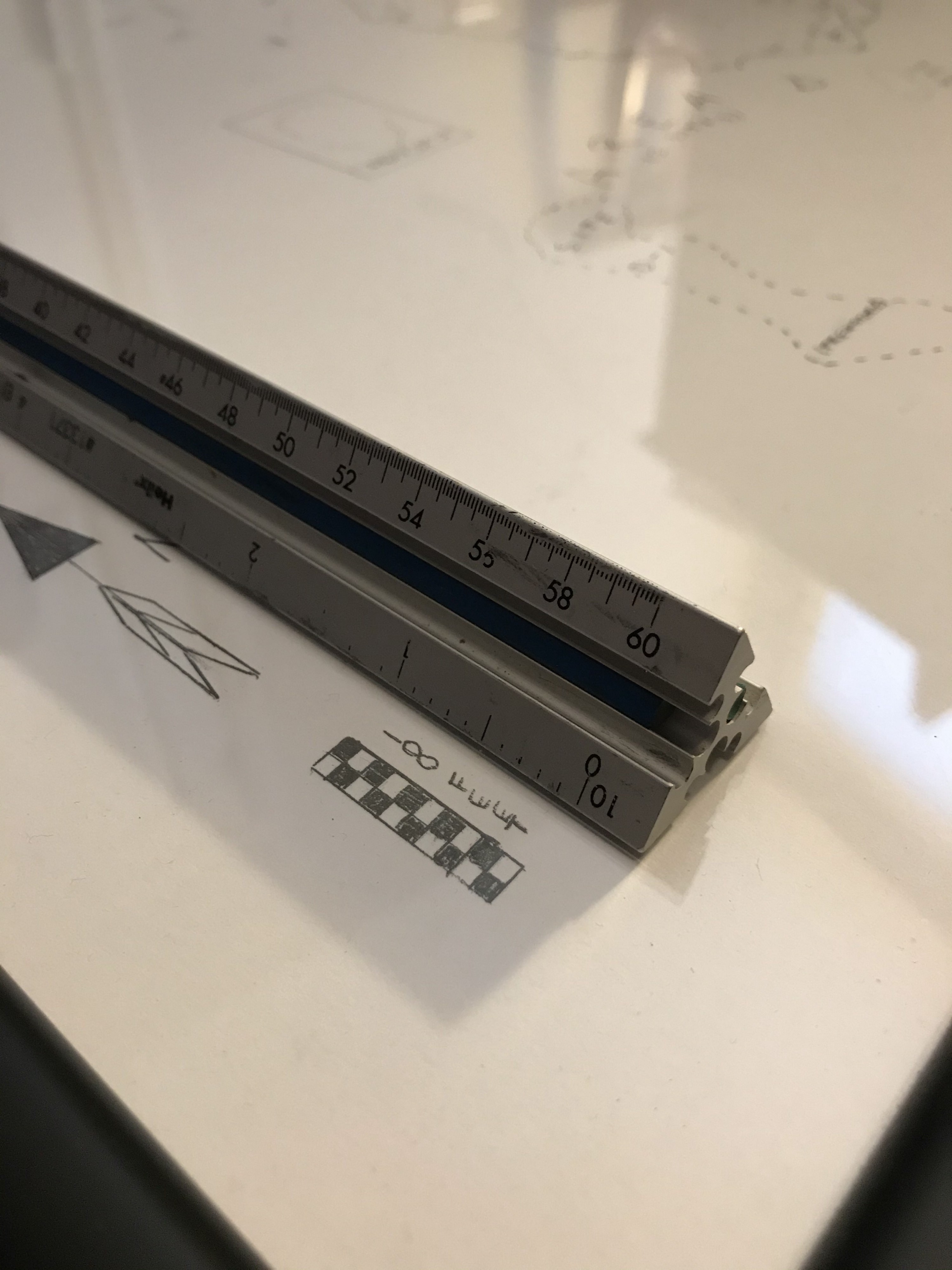 The scale on this map is 1 inch to 100 feet. The 1:10 edge on the engineer?s scale is the easiest to use in this example.
2. Line up the engineer?s scale with the map?s scale. Unless the map has been reprinted, a US map will usually have the scale with one inch as the base unit of measure. You should be able to use one side of your engineer?s scale to match up to the given scale. In the pictured example, we?ll use the 1:10 edge because that works well with 1 inch being 100 feet. Just remember that each little tick mark is 10 feet, not just one.
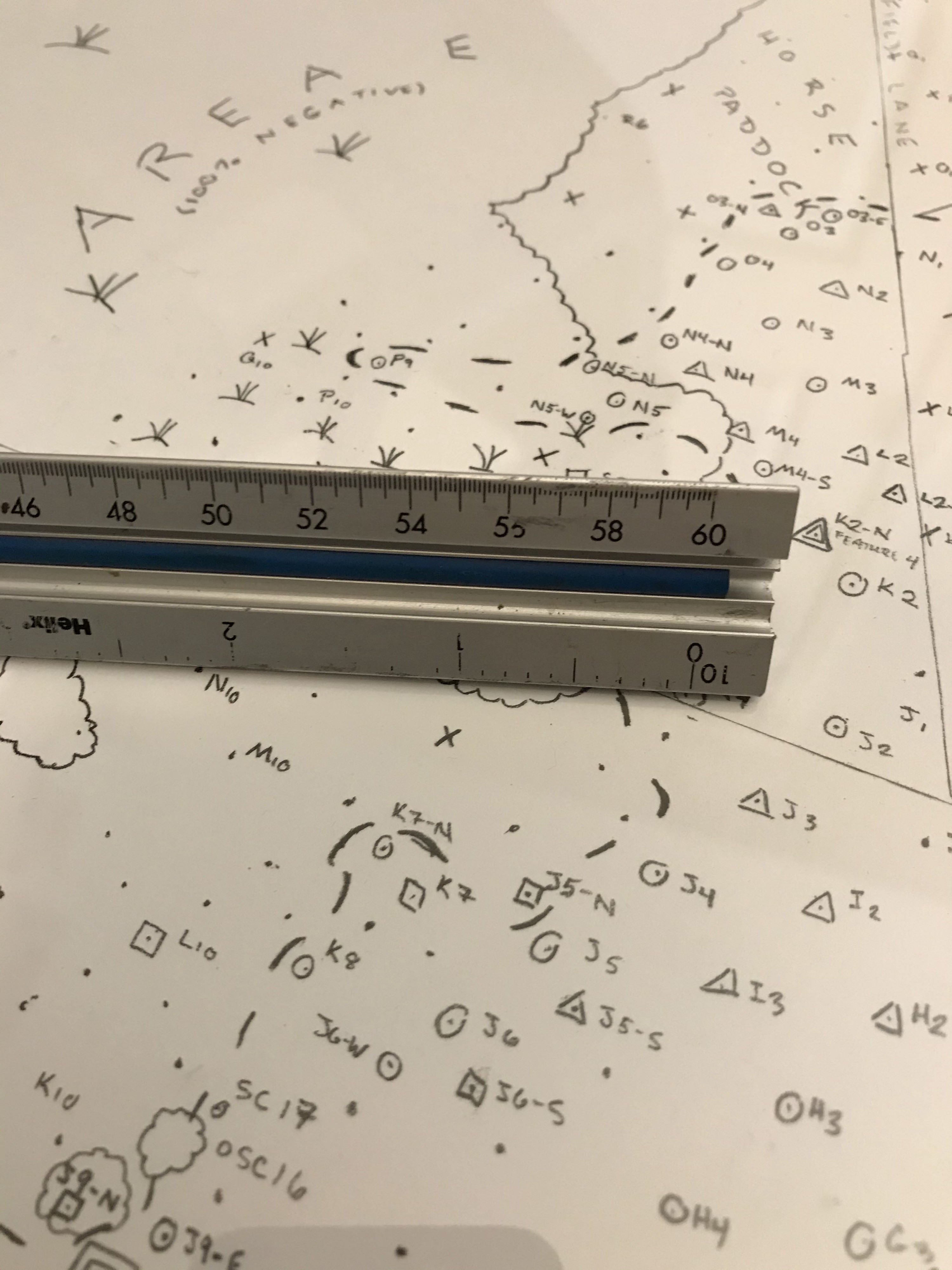 This engineer?s scale is a bit worn, but you can still see that it is approximately 2.15 inches between the two points on the map. With this map?s scale, that?s 215 feet.
3. Now, let?s measure between a ransom pair of shovel tests on the map. A bit obscured beneath the one edge is a positive shovel test labelled K4. We?ll see how many feet it is to cut across to the negative shovel test labelled N10. Counting the tick marks, you?ll see it lands just between the 21st and 22nd marks. We?ll call it 21.5 marks as an estimate.
Recall that on this map, 1 inch (or 10 tick marks) is equal to 100 feet. So 2.15 inches (also known as 21 and a half tick marks) is multiplied by 100 feet.
This means 2.15 * 100 = 215 feet between shovel tests K4 and N10.
4. Now let?s try it one more time, just to make sure you?ve got it. Take a look at the image below and try to calculate the distance between shovel tests J15 and G18.
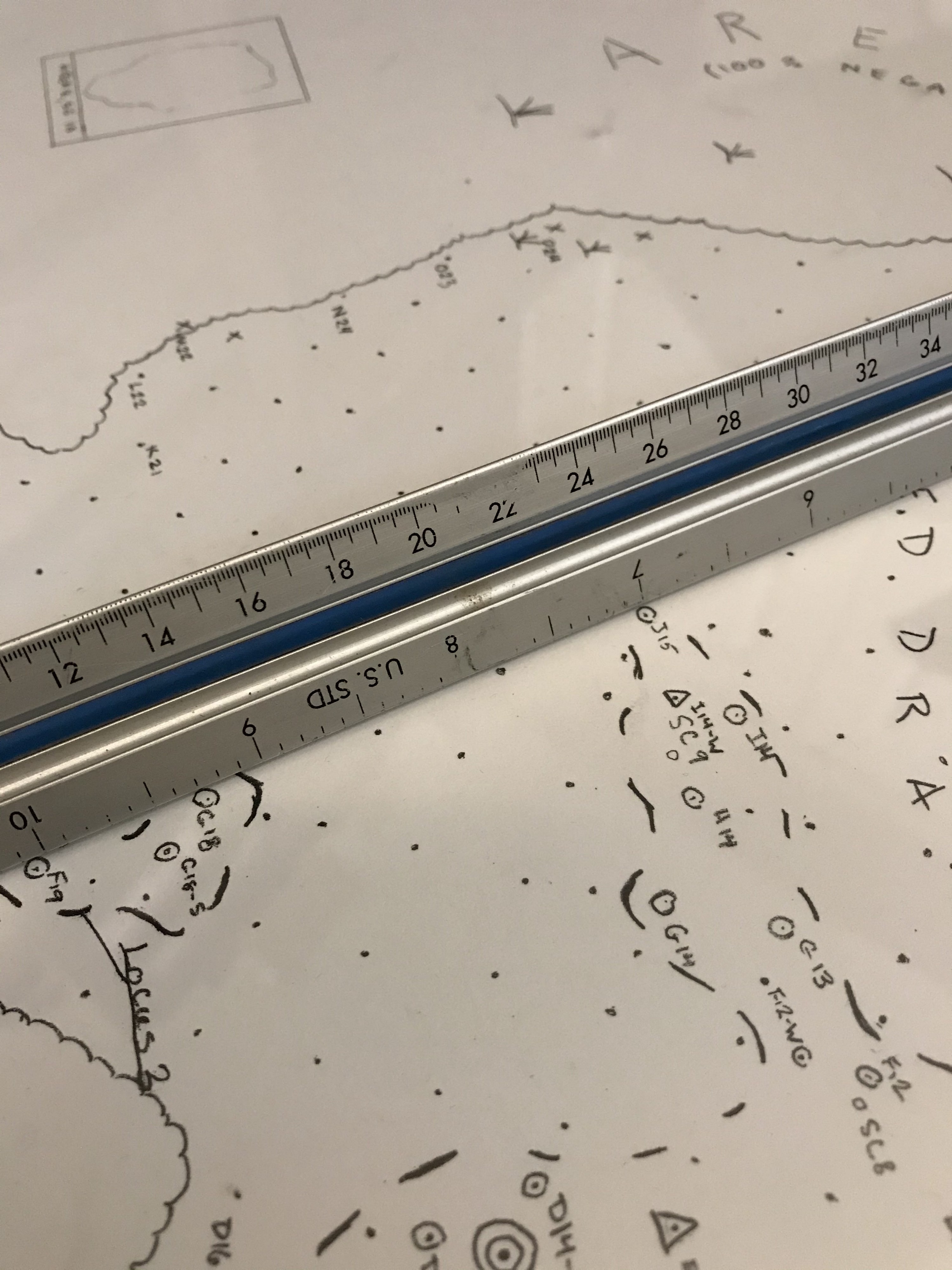 There are 2.3 inches between shovel tests J15 and G18. With this map?s scale of 1 inch to 100 feet, that?s 230 feet.
This is a bit of a curve ball, but also reminds you that it?s possible to measure from any point on the scale to another. Shovel test J15 is at the 7 inch mark (70th tick mark) and G18 is at 9.3 inches (93rd tick mark). That?s a total of 23 tick marks/2.3 inches between them.
So we have 2.3 * 100 = 230 feet between shovel tests J15 and G18.
If you got that right, then congratulations! Make sure you have the bare minimum compass skills as well, as outlined in an earlier article. The next step is to combine them for some basic cartography skills, which we?ll pick up in a forthcoming article.
Like archaeology-specific articles?Following A Bearing With A Compass Field Dogs: An Endangered SpeciesAlcoholism In ArchaeologyDon?t Be ?Mayonnaise Stan?7 Hacks For Archaeologists To Save For Retirement
Have comments, questions, suggestions for future articles, or just want to say you hated something published in Cultural Resource Management? Email us at [email protected]
