When it comes to understanding risk in a fast-moving world, recent and frequent satellite imagery offers the advantage of slowing down time and seeing events as they unfold.
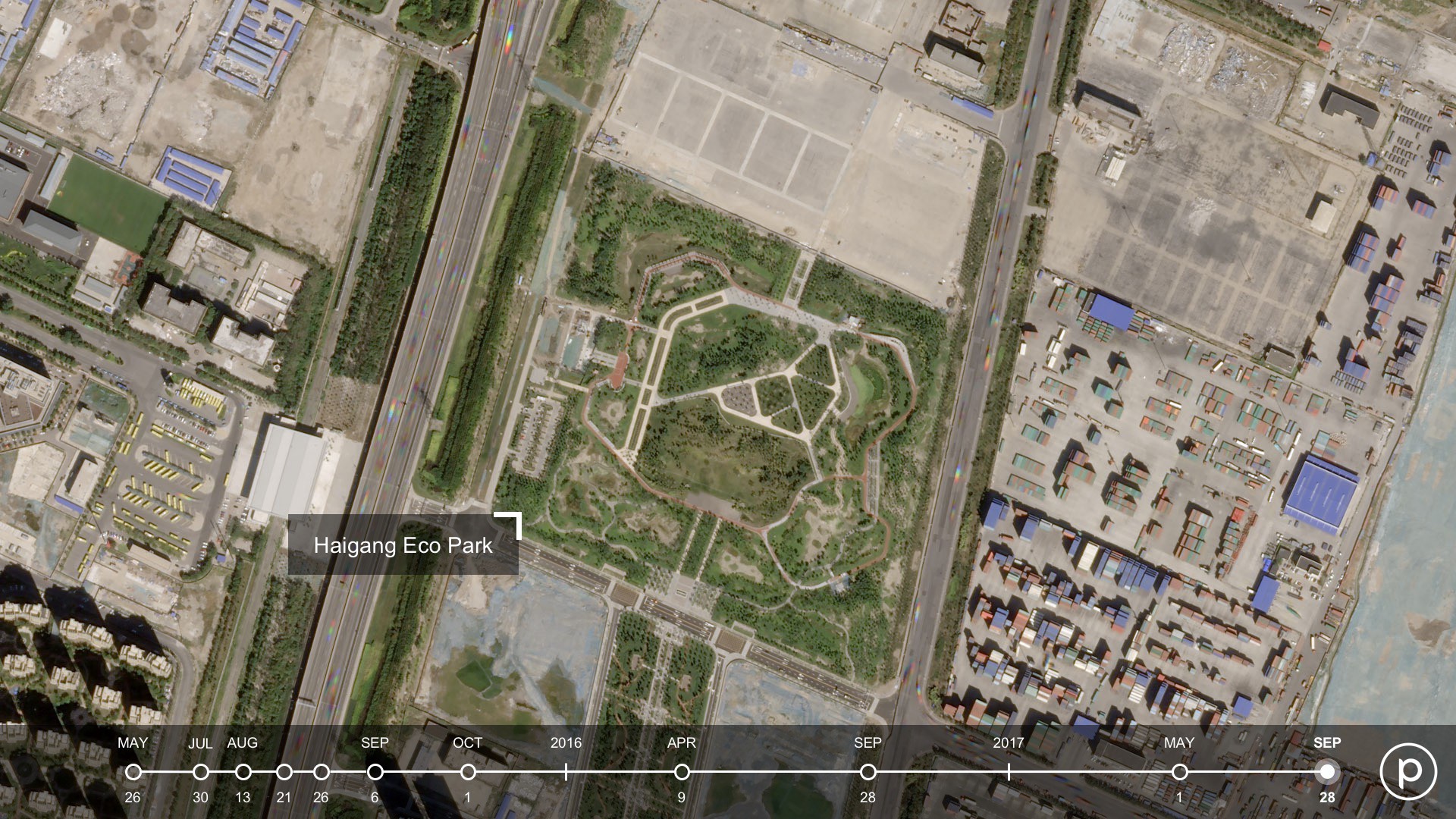
Two and half years ago, a series of explosions devastated the port city of Tianjin, China, killing more than 160 people and leveling buildings and homes in its wake. Today, a lush 60-acre ?eco park? stands at the site, bearing little resemblance to the crowded industrial complex that were conditions for disaster.
The Tianjin explosion site offers a case study in how Planet?s SkySat data can help people and organizations understand the risk factors before an event, as well as how to mitigate risk factors in the future.
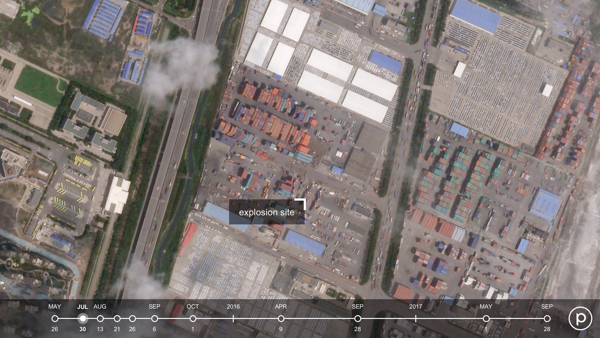
A Maze of Shipping Containers and Warehouses
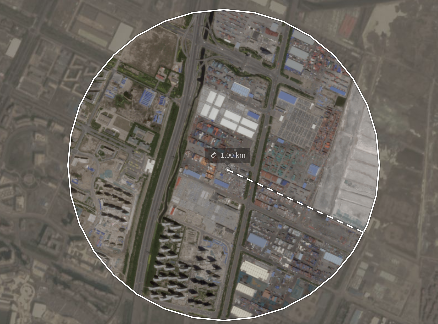 Recreation of a 1,000-meter buffer zone from the blast site shows violations of regulations intended to protect people and property.
The Tianjin explosions have become symbolic of the pitfalls of rapidly urbanizing economies, where lax enforcement, lack of transparency, and quick approvals can create conditions for disaster. Despite Chinese regulation for a 1,000-meter buffer zone from hazardous chemical companies, the imagery above shows how the transport and illegal storage of chemicals happened near port facilities, public buildings, residential complexes, and major thoroughfares.
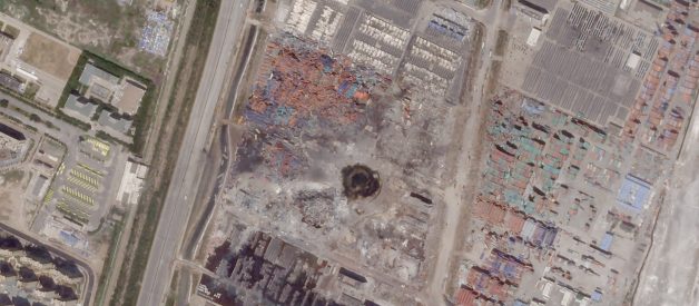
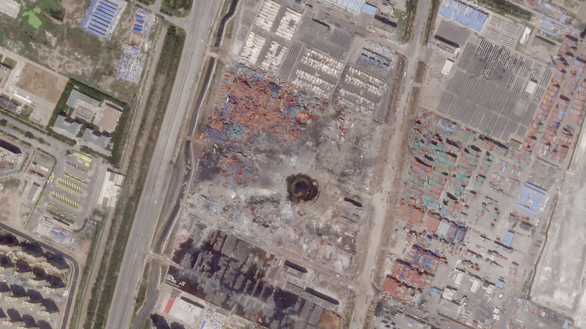
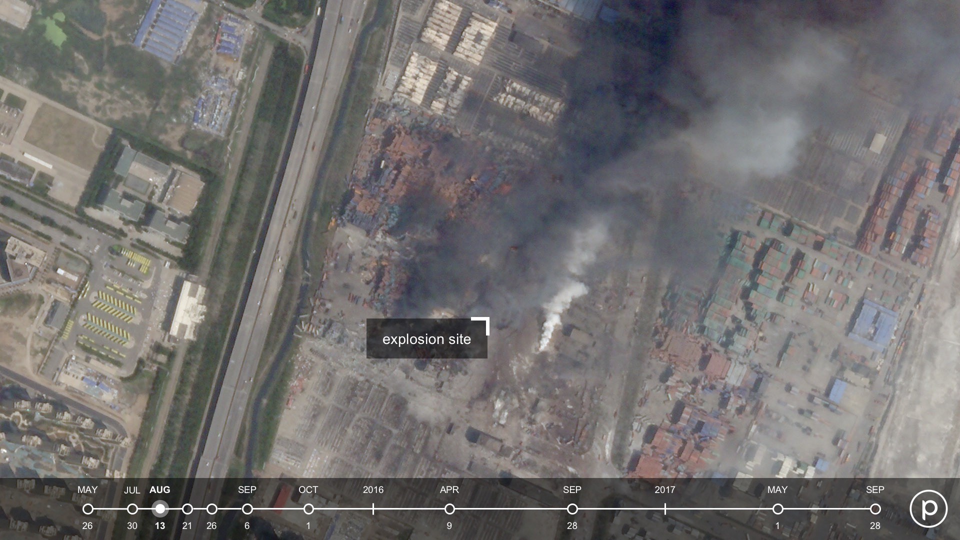
The explosions
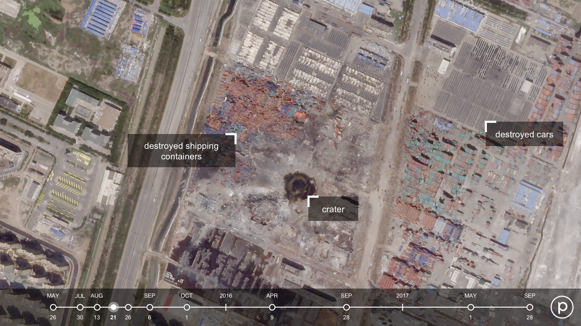
A Planet SkySat captured the extent of the devastation shortly after the explosions shook Tianjin on August 12. Thousands of cars in nearby storage melted from the heat and buildings were destroyed more than a kilometer away. When the fires subsided and the smoke cleared, a deep toxic crater remained. In the image below, destroyed shipping containers can be seen to the left of the crater, while the rows of shelled automobiles can be seen to the upper right.
A slow recovery
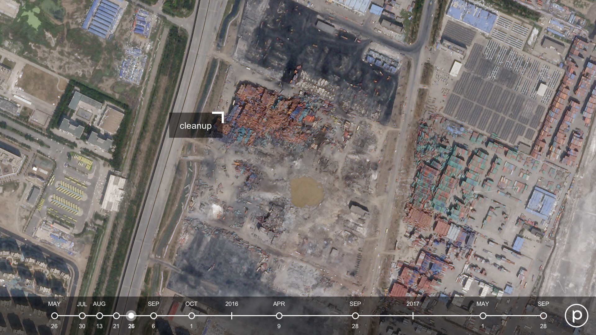
Nearly a month after the explosions, the clean-up and recovery of the site made visible progress, and the port of Tianjin had resumed day-to-day operations in early September. However, the economic impacts of the port closure went well beyond the region. The port of Tianjin is the third largest in the world by cargo volume, and reports warned that negative ripple effects across the supply chain would last for months. Companies and organizations were compelled to change their shipping routes and work with different suppliers and partners in the interim.
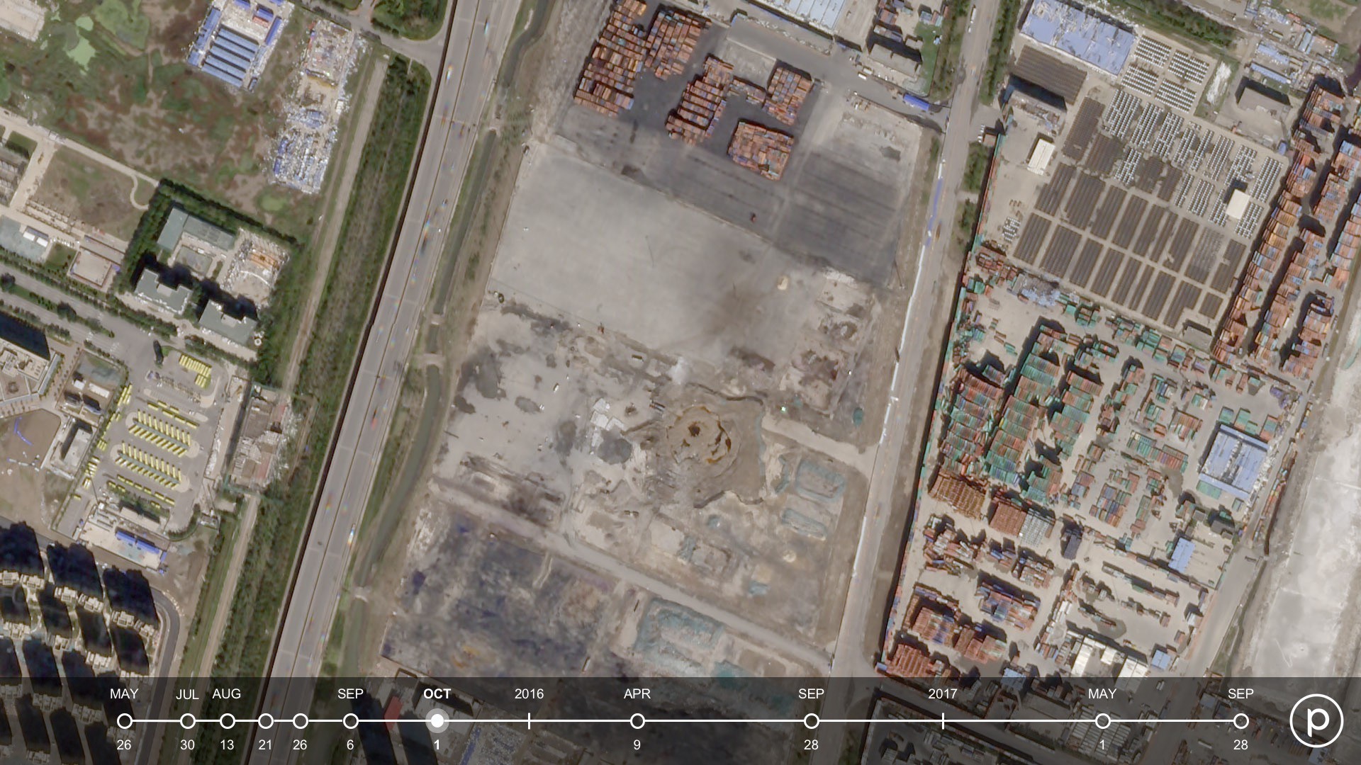
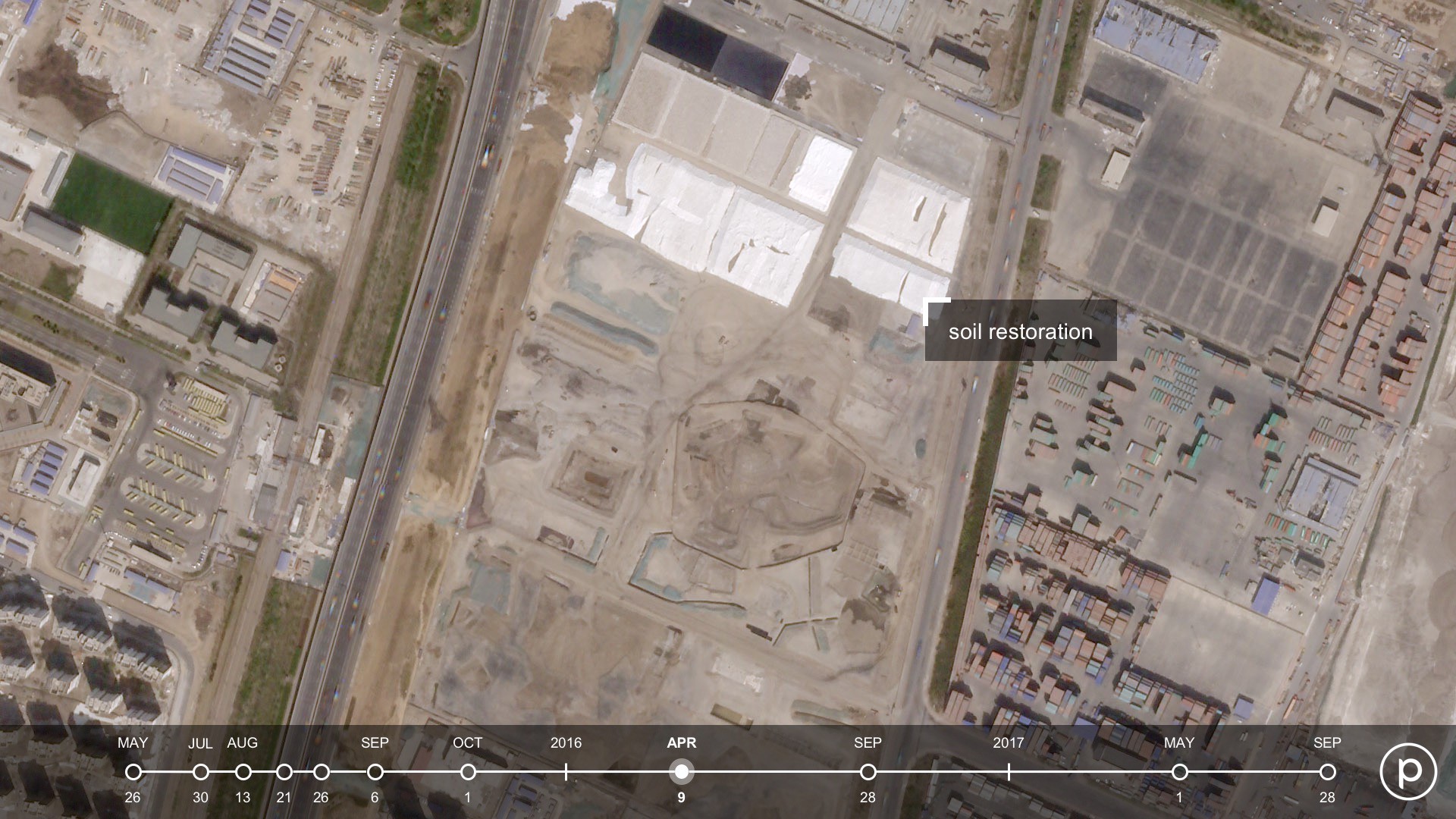
Once the crater was filled and covered, efforts to remove toxic waste from waterways and restore the soil were in full swing in spring 2016. Meanwhile, insurers were deep into evaluating and processing claims from across the globe. Swiss Re estimated that insurance payouts totalled around $3.5 billion, making Tianjin the largest ever man-made loss in Asia.
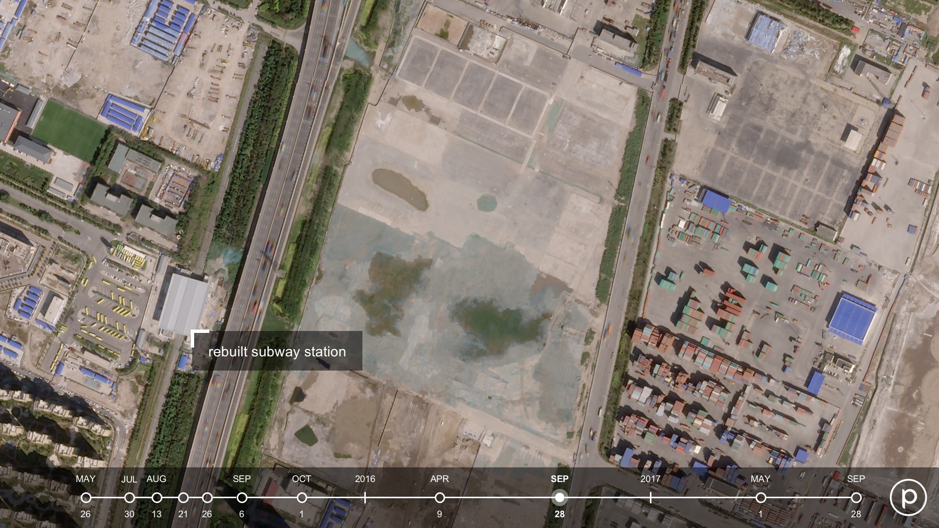
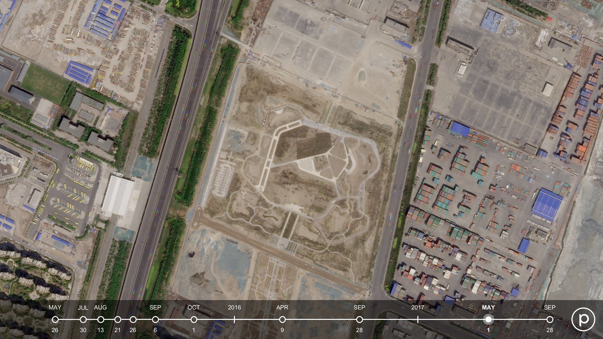
To memorialize the explosion sites, the city built a 60-acre eco park that in addition to green spaces, contained two schools. New surrounding infrastructure, including a new railway station, and consistent traffic on thoroughfares showed that life has resumed.
One major lesson coming out of the Tianjin explosions has been the increasing need for up-to-date data on global port facilities, industrial parks, and high-traffic warehouses ? where risk of man-made disasters may be higher. Safety regulations (and enforcement of those laws) vary greatly by regions and countries. Sadly, in the years since Tianjin, a number of man-made disasters have shook other parts of the world.
As global economies become even more tightly interlinked, frequent imagery of port activity, shipping container turnover, movement and storage of goods, and infrastructure changes help people and businesses gain a comprehensive view of their assets at any given time and location. Ultimately, this can a create a safer, more transparent world for all.
To get the latest news and imagery from space follow Planet on Twitter and subscribe to our Medium. Images 2018 Planet Labs, Inc. cc-by-sa 4.0

