This is a geography post in which I?ll illustrate where on earth Kosovo actually is. I?m using the teaching technique of maps, so if you don?t like maps, skip this blurb and come back next time. I like maps.
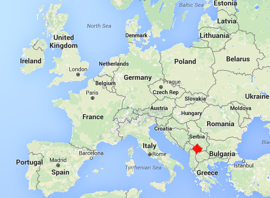
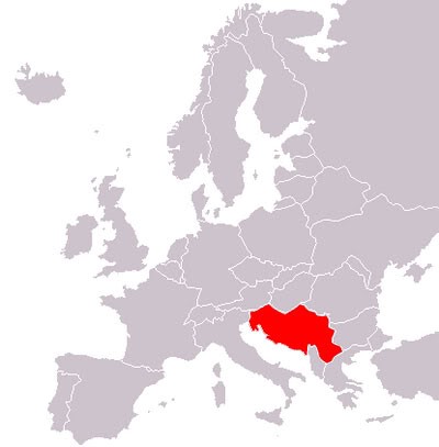
Kosovo is highlighted in red. It?s north of Greece and east of Italy, landlocked in the Balkans.
Kosovo is comparable in size to Cape Breton and has a population similar to the Maritimes.
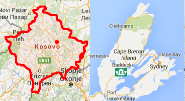
- Kosovo: 10,910 km
- Cape Breton: 10,310 km
? ? ? ? ? ? ? ? ?
- Kosovo: 1.85 million people
- Maritimes: 1.81 million people
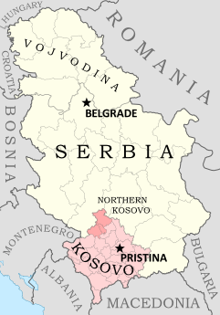
Serbia, which denies Kosovo?s independence, is the size of New Brunswick and has a population equal to the sum of five Canadian provinces and the territories.
- Serbia (without Kosovo): 77,474 km
- New Brunswick: 72,908 km
? ? ? ? ? ? ? ? ? ? ?
- BC, Atlantic Canada, & The territories: 6.83 million people
- Serbia (without Kosovo): 7.04 million people
From theses stats, the population density of Kosovo and Serbia sounds high, but by European standards it?s average. Makes you appreciate how wonderfully sparse Canada is, eh?
Kosovo is 92% Albanian, whereas Serbia is predominately Serbian. That?s the root of the tension in Kosovo: the conflict between the Serbs and the Albanians. Due to reasons that I?ll explore next post, the Albanians of Kosovo wanted out of Serbia.
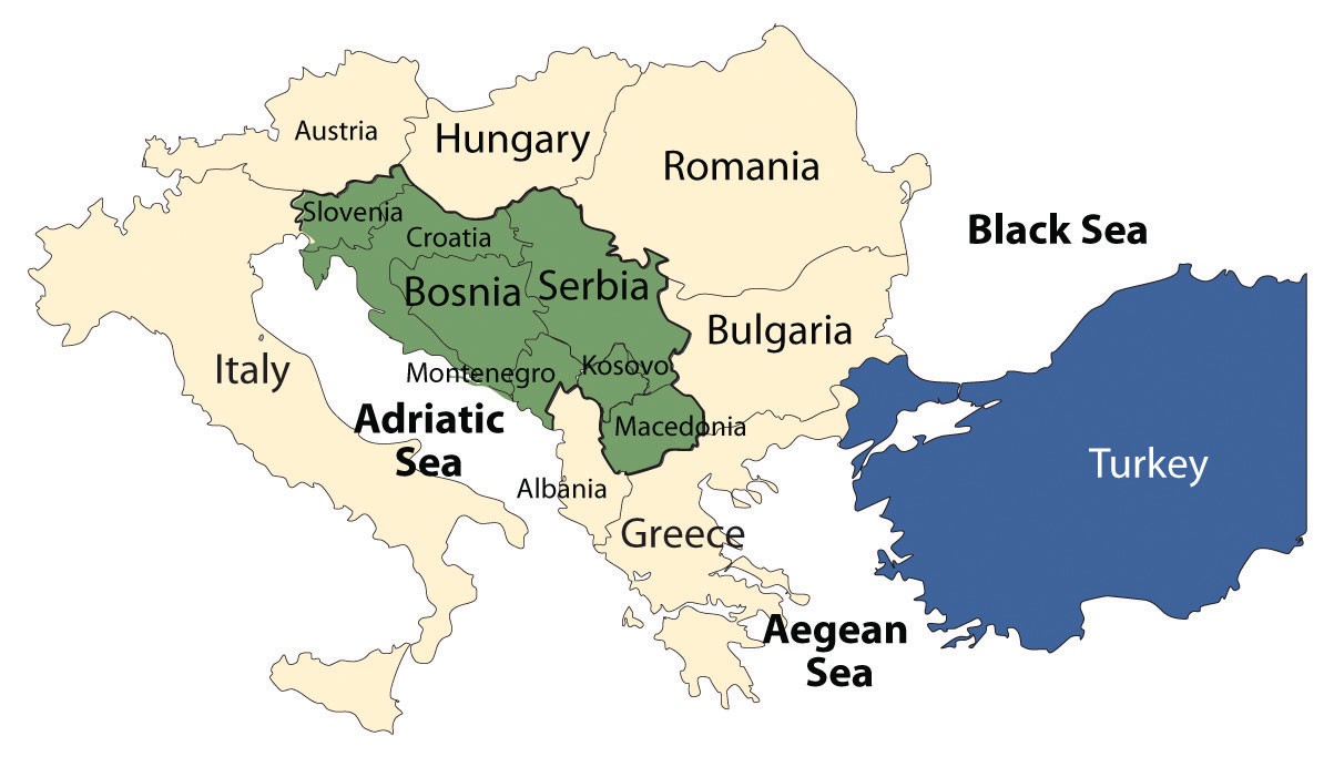
Between 1949 and 1990 this area of the Balkans was Yugoslavia.
 1990 Yugoslavia
Yugoslavia was comprised of 6 states: Slovenia, Croatia, Bosnia, Serbia, Montenegro, and Macedonia, as well as two autonomous provinces: Kosovo & Vojvodina.
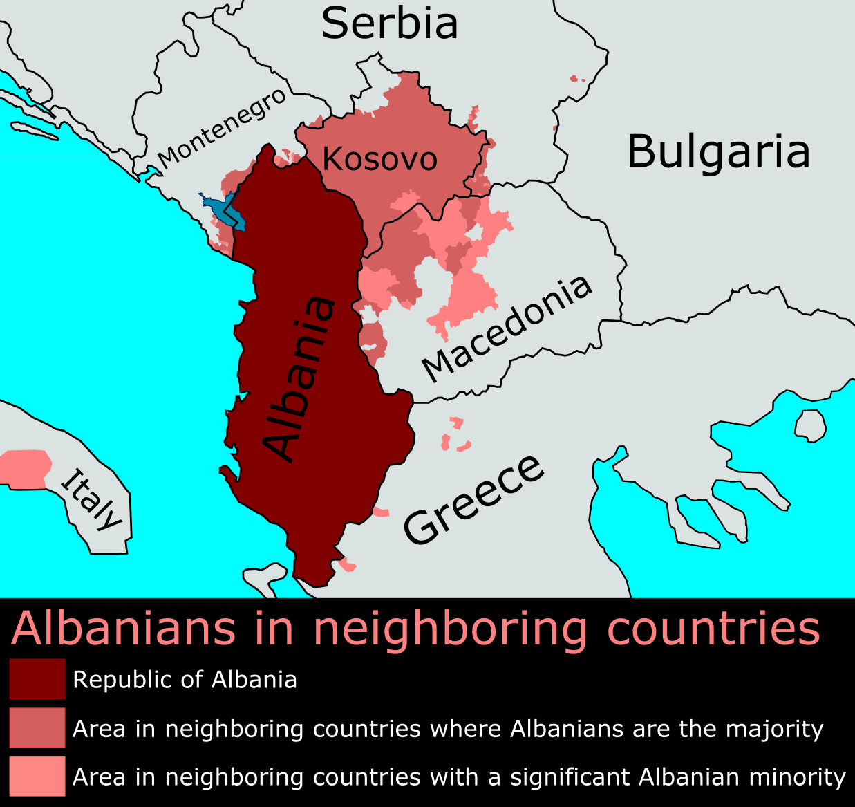
Since 1990 Yugoslavia has been slowly breaking apart into its components, and Kosovo might be the last piece to break free. Since the region had so much ethnic overlap, creating states that reflect the geographical distribution of each ethnicity has been a long and painful process. Look at Bosnia and Herzegovina?s ethnicities for example: there wasn?t a pleasing border solution to be found.
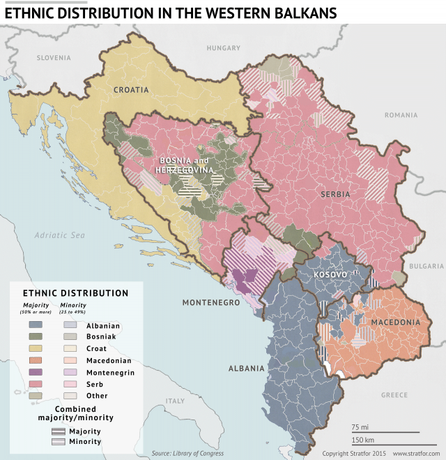
In the map above, keep in mind the dark colours display the majority ethnicity. Most areas with a majority of one ethnicity still have significant minority populations of the other ethnicities. Serbs in Croatia, Croats in Bosnia, Albanians in Serbia. Everyone?s all over the place, and I?ll get into how that shaped Kosovo in the next post.
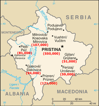
Pristina
I can?t get a concrete number on how many people live in Pristina because it seems the population fluctuates a lot with the seasons, and even with the weekends. But I?ve concluded that Pristina is somewhere between the size of Halifax and Winnipeg.
Pristina is in a valley. The two photos below are taken from the tallest hill on the edge of the valley. Looking away from the city you can see Serbia in the distance.
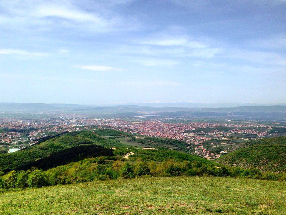 Pristina from the top of Germia Park
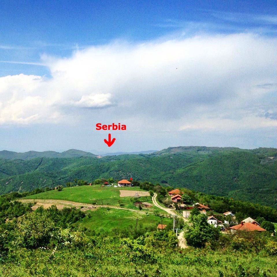 Looking away from Pristina at the top of Germia Park
Now you know where Kosovo is! Since moving here, I?ve started noticing the age of European maps by how they portray the Balkans.
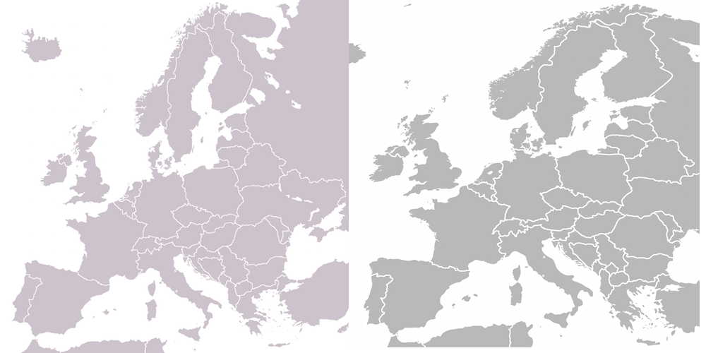 Spot the difference
Until next timeDS
Next up:
- Blog #5: What is Kosovo
- Blog #6: Camp TOKA
- Blog #7: Albanian countryside
- Blog #8: David?s Projects